Underneath 3 kilometers of solid Antarctic ice, scientists have just found something they never expected: an ancient river landscape. Not a fossil, not a volcano, not a buried city—this is a preserved network of rivers frozen in time. Even more surprising, it might be playing a crucial role in slowing down the movement of ice sheets, buying us time in the fight against rising sea levels.
Let’s look into this remarkable discovery and why it matters more than we ever imagined.
Table of Contents
Discovery

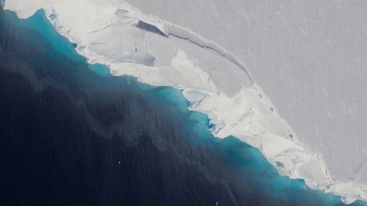
This frozen secret was uncovered by researchers from the British Antarctic Survey. Using ice-penetrating radar attached to a small Twin Otter aircraft, they were scanning the land beneath East Antarctica. It seemed like just another routine flight—until the radar picked up something unexpected.
Beneath the surface was not just ice or mountain ridges, but a fully intact ancient river system, frozen solid for more than 30 million years. And yet, even after all this time, it’s still making a difference today.
Frozen
This river system stretches across 3,500 kilometers. Millions of years ago, it likely flowed like any other, carrying water through valleys and channels. But everything changed when Antarctica separated from Australia and the region began to freeze.

As temperatures plummeted and ice took over, the entire river system was buried. But unlike most natural features that get worn down over time, this landscape was protected. The thick ice preserved it, shielding it from rain, wind, and erosion. It was like being placed inside the planet’s own deep freezer.
And now, that very preservation is affecting how glaciers behave today.
Friction
Why does a frozen riverbed matter? Because it acts like a brake.

The rough, uneven terrain of this ancient riverbed creates friction beneath the glaciers above it. Instead of sliding quickly, the ice moves slowly. That slowdown could be what’s currently delaying the massive melt of East Antarctica’s ice sheet.
To put it in perspective, if the East Antarctic ice sheet were to melt entirely, global sea levels would rise by over 50 meters. Not centimeters. Meters. That would reshape coastlines, drown cities, and force millions of people from their homes.
But this frozen terrain might be helping to stop that disaster—for now.
Radar
Seeing something buried beneath three kilometers of solid ice isn’t easy. Scientists used advanced radar technology mounted on aircraft to do it. The radar sends signals down through the ice and listens for echoes bouncing off the surface below. These echoes are then translated into detailed images of what lies beneath.
It’s a method that lets us look into Earth’s deepest secrets without digging a single hole. In this case, it revealed not just a feature of the past, but a structure still influencing the present.
Shift
Until now, most studies about Antarctica’s ice have focused on what’s happening above: how fast it melts, how much it shrinks each year. But this discovery changes that approach. Now we know that what’s below the ice is just as important—maybe even more.
Understanding how ice flows, not just how it melts, is critical. That flow depends heavily on what’s beneath. If we ignore that, we’re missing a major piece of the climate puzzle.
Warning
The ancient river landscape doesn’t shout, doesn’t shake the Earth, doesn’t flash across the sky. But like a quiet guardian, it’s been holding back disaster for millions of years. If that natural brake disappears—if the ice melts or the ground shifts—then glaciers could suddenly begin to slide faster, and the consequences would be immediate.
Think of it like a silent character in a story, doing important work behind the scenes—like Hodor in Game of Thrones, holding the door as long as he can. But eventually, that door may open.
And when it does, the world won’t be ready.
FAQs
What did scientists find under Antarctica?
An ancient, intact river landscape buried beneath the ice.
How old is the buried river system?
It’s over 30 million years old and frozen in place.
Why is this discovery important?
It slows glacier movement, delaying sea level rise.
How did scientists find it?
Using ice-penetrating radar mounted on an aircraft.
What happens if this landscape disappears?
Ice may move faster, causing rapid sea level rise.