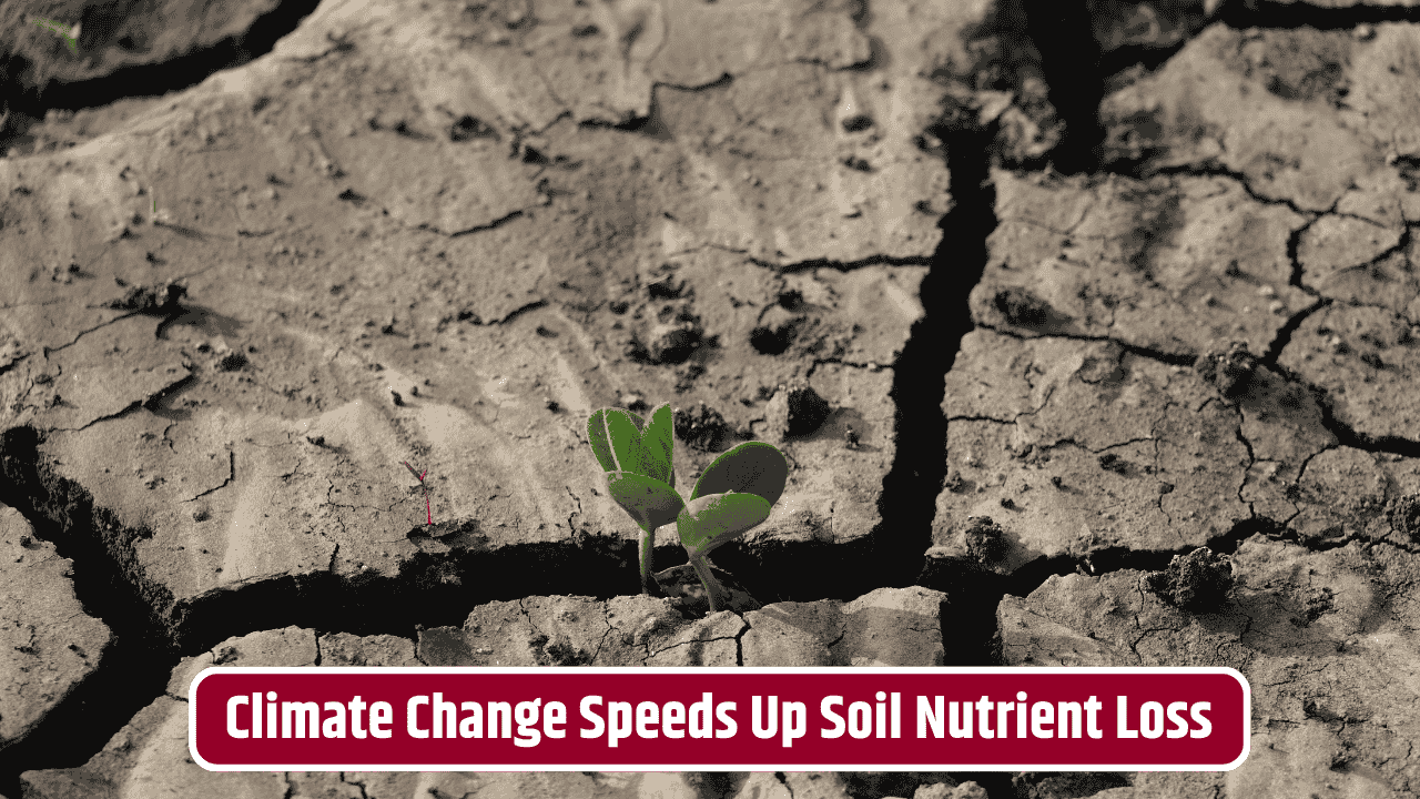
When you look at a landscape, you’re really staring at a history book written in stone and soil. The ridges, valleys, slopes, and the very grains of sand beneath your feet aren’t random—they’re the leftovers of battles fought between water, wind, ice, and gravity over millions of years. A hill isn’t just “a hill”; it might be the carcass of an ancient glacier’s path. A pebble sitting in a stream isn’t just a pebble; its roundness or sharpness is a coded message about how far it has traveled.
Table of Contents
Topography as a Storyteller
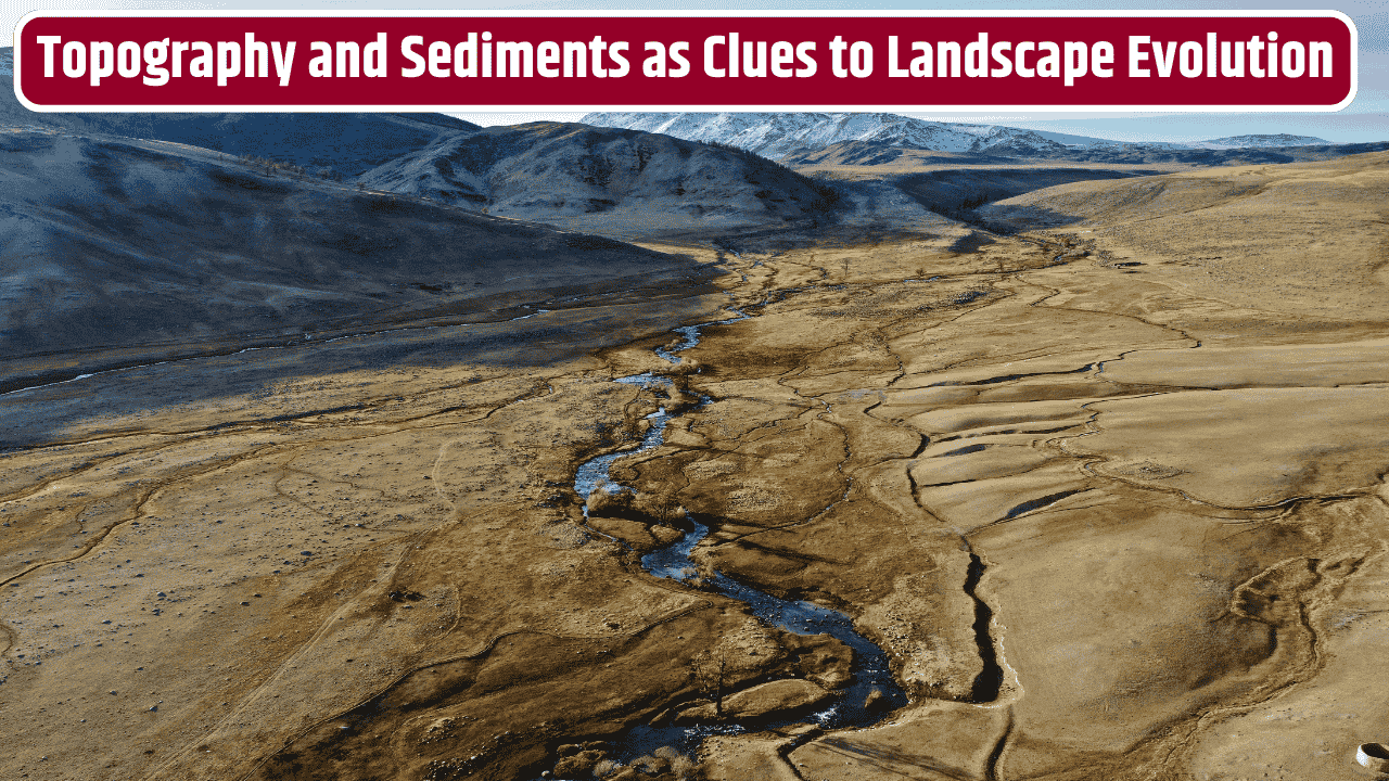
Topography—the physical shape of the land—offers the first big clues. Steep mountains usually mean geologic forces are still actively at work, pushing up rock faster than erosion can grind it down. Think of the Himalayas: young, jagged, still “growing.” On the other hand, broad rolling hills or flat plains often signal older, weathered terrains that have been worn smooth by countless cycles of rain and wind.
Valleys carved in a “V” shape usually tell you rivers did the heavy lifting, cutting down into bedrock over time. Compare that to “U”-shaped valleys, which are like giant signatures of glaciers, gouging and bulldozing their way through the landscape during ice ages. Even the way rivers meander across a floodplain can reveal whether the land is still sinking, rising, or just sitting quietly.
Sediment Size and What It Means
Now, zoom in from the mountains to the particles underfoot. Sediment size is basically nature’s travel diary. Large, angular boulders? They haven’t moved far from their source—maybe they tumbled down a cliff or were left by a melting glacier. Small, smooth pebbles? That’s a long journey, rolled around by rivers until sharp edges wore down. Fine clays? Those usually settle only in very calm environments, like lakes or ocean floors, where water is slow enough to let tiny particles drift down.
Here’s a quick snapshot:
| Sediment Size | Shape/Texture | Likely Environment | What It Tells Us |
|---|---|---|---|
| Boulders | Angular | Near cliffs, glaciers | Minimal transport, fresh breakage |
| Pebbles | Rounded | Riverbeds, beaches | Long transport, constant abrasion |
| Sand | Moderate, gritty | Deserts, rivers, coasts | Energy-rich environment with active movement |
| Silt/Clay | Very fine, smooth | Lakes, ocean basins | Quiet water, long-term deposition |

This table is more than trivia—it’s a decoder ring for understanding how landscapes were shaped and what forces dominated their history.
Reading Landscapes Like a Detective
When geologists read landscapes, they act like detectives piecing together a cold case. For example, if you find rounded pebbles on top of a mountain, you know water once flowed much higher than it does now. A flat, elevated plateau could be the remnant of an ancient floodplain that was lifted skyward by tectonic forces. Even soils, layered like cakes, can tell stories of floods, droughts, volcanic eruptions, or human agriculture.
Take the American Midwest. The rolling plains there weren’t just random accidents—they were sculpted by glaciers that ground down mountains and then spread sediment across the land like butter on toast. Meanwhile, in places like Arizona, the sharp cliffs of the Grand Canyon scream about rivers relentlessly slicing through rock for millions of years, exposing layer upon layer of Earth’s diary.
Why This Matters
Understanding topography and sediment isn’t just an academic game. It has very real implications for us today. Engineers need this knowledge to build stable roads and bridges. Farmers depend on soil history to understand fertility. City planners must account for floodplains and erosion risks. And climate scientists use sediment cores pulled from lakes and oceans to reconstruct past climates, giving us a glimpse into how the Earth might change in the future.
The U.S. Geological Survey (USGS) has been mapping these features for decades, providing invaluable data for everything from disaster management to land use planning (USGS Topography and Sediment Studies). These aren’t just static maps—they’re living records that update our understanding as landscapes continue to shift under our feet.
The Bigger Picture
Every ridge and ripple of Earth’s surface is like a fingerprint. By reading topography and sediment size together, we get a layered, almost cinematic understanding of the land’s past. We see not just the what, but the how and why. It’s humbling, really—reminds you that the ground we walk on is never truly still. It’s been shaped by forces far older and stronger than us, and it’ll keep changing long after we’re gone.
FAQs
How do geologists measure sediment size in the field?
They often use sieves with different mesh sizes, visual comparisons, or laser diffraction tools to categorize grain sizes accurately.
Can human activity alter natural topography and sediment patterns?
Absolutely. Mining, construction, deforestation, and dam-building all reshape landscapes and alter how sediment is transported.
Why are rounded pebbles always linked to rivers or beaches?
Because the constant tumbling and abrasion in moving water smooths out sharp edges over time.
What’s the difference between erosion and weathering?
Weathering is the breakdown of rocks in place (like cracking or dissolving), while erosion involves the movement of those materials by wind, water, or ice.
How do scientists use sediments to study past climates?
By analyzing layers in lake or ocean sediment cores, they can track changes in temperature, vegetation, volcanic activity, and even atmospheric CO₂ levels.