It’s wild to think about how much we take soil, water, and rocks for granted—until you realize those hidden layers of Earth are basically life’s support system. Back in the early 2000s, a group of scientists decided to stop studying these pieces in isolation and instead treat the entire “critical zone” (the thin slice of Earth from the tree canopy down to groundwater) as one interconnected system. That shift sparked the birth of Critical Zone Observatories (CZOs), and honestly, they flipped Earth science upside down.
Table of Contents
What Exactly Is the Critical Zone?
The critical zone is sometimes called Earth’s “living skin.” It’s where rock turns into soil, where water cycles through, and where life actually thrives. Think of it as the middle ground where geology, biology, hydrology, and even human activity collide. Before CZOs, researchers often worked in silos—geologists studied bedrock, hydrologists tracked streams, ecologists focused on plants. But the big picture was missing.
The Birth of Critical Zone Observatories

The idea gained momentum in the U.S. when the National Science Foundation funded the first wave of CZOs in 2007. Sites popped up across the country—from Pennsylvania’s shale landscapes to California’s Sierra Nevada forests. Each location became a “living laboratory,” packed with instruments that measured soil chemistry, erosion rates, tree growth, and how rainwater trickled into aquifers.
What made them revolutionary wasn’t just the tech, but the mindset: instead of short-term projects, CZOs were built for decades-long data collection. Earth processes don’t reveal themselves in a single season, so this was like planting scientific roots that would grow deeper with time.
A Network That Went Global
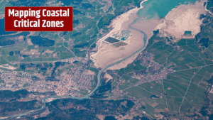
The U.S. observatories set the stage, but soon Europe, China, and other regions joined in, creating a worldwide network of Critical Zone Observatories. These global collaborations meant researchers could compare how different climates, geology, and land uses shaped the zone. For example, scientists learned how deforestation in tropical regions changes water infiltration dramatically compared to temperate forests.
| Year | Milestone | Impact |
|---|---|---|
| 2001 | NSF workshops on Critical Zone | Concept formally outlined |
| 2007 | First U.S. CZOs funded | Long-term Earth monitoring begins |
| 2013 | European CZOs established | Expansion beyond U.S. |
| 2018 | Global CZO network | Shared data across continents |
| 2020 | Transition to CZO “collaboratives” | More integration with society and policy |
How They Changed Earth Science Forever

Here’s the kicker: CZOs didn’t just create more data, they forced scientists to think holistically. A study of soil erosion suddenly had to account for rainfall changes, vegetation cover, and even farming practices. Groundwater research had to consider how forest management affected infiltration. That interdisciplinary approach is now baked into modern Earth science.
Even climate change models benefited. Data from CZOs helped refine predictions on how landscapes respond to extreme weather—whether soils can buffer drought, or how fast nutrients wash away in floods. Agencies like the U.S. Geological Survey and National Science Foundation still rely on insights from these observatories for water resource planning and environmental policy.
Beyond Science: Why You Should Care
If you drink water, eat food, or live on land (so, everyone), you’re tied to the critical zone. CZO research has direct implications for agriculture, urban development, and disaster management. For instance, knowing how soils store carbon informs strategies to fight climate change. Understanding how wildfires alter watersheds can help cities prepare for water shortages.
And here’s a fun twist—many CZOs involve local communities. Farmers, land managers, and policymakers often collaborate with scientists, so findings aren’t just academic—they shape real-world decisions.
FAQs
What is the main purpose of a Critical Zone Observatory?
To study the interconnected processes in the Earth’s “critical zone,” including soil, water, rock, and ecosystems.
Are CZOs still active today?
Yes, though many U.S. sites transitioned into Critical Zone Collaborative Networks in 2020, continuing the same mission with more community involvement.
How do CZOs help with climate change research?
They provide long-term data on soil carbon storage, water cycles, and vegetation changes, all crucial for modeling climate impacts.
Where are some famous CZOs located?
Examples include the Susquehanna Shale Hills in Pennsylvania, Southern Sierra in California, and the Eel River in Northern California.
Can the public access CZO data?
Yes, much of the data is publicly available through NSF and related research portals, making it useful for educators and policymakers alike.